Our friends mentioned in mid-summer that they would be in Texas for a few days in 3rd week of October. Wondered if we would like to join them for a few days exploring San Antonio and Austin. On reflection, we thought that we should be able to cobble together an interesting road trip there and back. We were in!

We already had the Alpine Club of Canada Guides Ball event booked at Lake Louise on October 14, my friend Peter Amann was to be honoured that evening as Patron. Therefore we could leave no earlier than October 15. We landed on the rough idea to head east to the Black Hills of South Dakota and then south to Texas, seeing whatever might be interesting along the way. We would return farther west hoping to pass a few other new places including Santa Fe and Taos. We booked a Chris Hillman/Herb Peterson concert in Park City Utah on October 28. This created some bookends to work from.
The Guides Ball at Chateau Lake Louise was a delightful event. Having packed for the road trip we drove to Lake Louise with our friend Keith midday on Saturday, October 14. In the afternoon Peter provided an excellent slide presentation of his time in the mountains over the last 40 years and later, after a very delicious dinner, made a great keynote address. Was a fun event, caught up with a few folks had not seen in awhile as well as met a few new. A good warm up event in advance of a 16 day road trip through 12 of the greatest states the US has to offer.
.
Day 1: White Post Lane to Hardin Montana

 |
| Milk River Solar Site |
 |
| Sweetgrass Border |
The Sweetgrass Hills were in clear view and beckoning us on to the United States of America.
A short drive had us to the Sweetgrass border and an uneventful entry into the Great State of Montana. Game on!
 |
| Sweetgrass Hills from US Hwy 2 |
 |
| Fort Belknap Water Tower |
We turned south on Montana Hwy 66 at Fort Belknap Agency. Immediately south of town there is a stunning art display on the area water tower. Later investigation showed the mural to be the centre piece of a project to improve the quality of water to acceptable standards. The Fort Belknap Indian Reservation (yes this is correct, they are not called First Nations in The US) is home to the Aaniiih and Nakoda tribes. You can read about the Fort Belknap water system improvement project at the link below. A great story.
Ft Belnap Water is life project
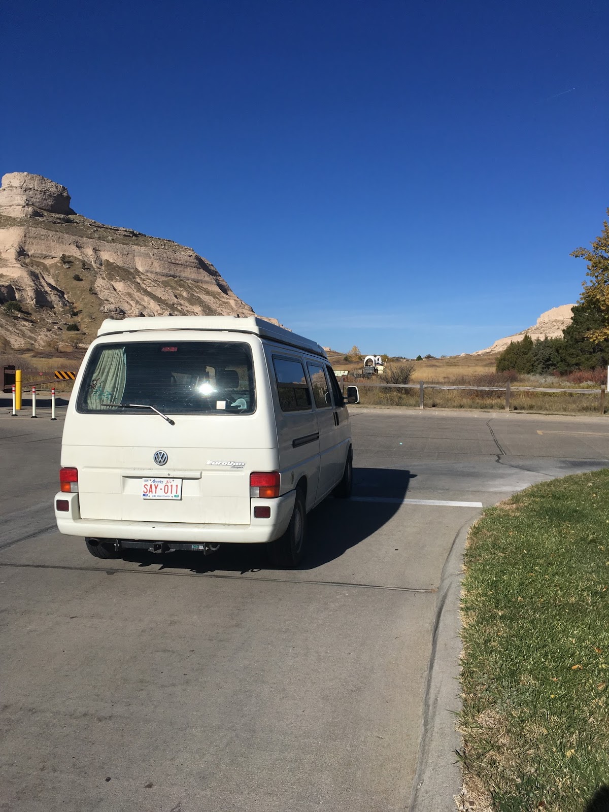
Many more hours of driving, over the Missouri River, past the Little Rock Mountains and Billings had us arrive at Grand View campground in Hardin Montana. Didn't notice the view as being particularly special, but it was getting near dark so time to stop driving after almost 1000 kms. One of the guests was standing in for the owner at the office. She apologized for the mess and smell and mentioned there had been a fire . Wasn't exactly sure what the rate for our vehicle might be so we settled on $30. The office was full of boxes and random stuff piled everywhere. She told us the fire happened from an electrical incident last December.... seems the insurance company had yet to settle and wasn't being cooperative.... apparently that kept the owner from tidying up..... go figure. It turned out to be a decent camping location, flat, hot showers, reasonably quiet... what more can you ask for?
Day 2: Hardin Montana to Custer State Park South Dakota
Little Big Horn Battle Field
Fortified with coffee from the Hot Shot Espresso shack just off I90 (why aren't there any of these in Canada?) we headed southeast for 20 minutes to the Little Bighorn Battle Field National Monument located a few miles south at junction of I90 and US 212.
 |
| Little Bighorn Indian Memorial |
 |
| "Last Stand Hill" with Little Bighorn 7th cavalry Obelisk |
 |
| Custer National Cemetery |
Devils Tower
 |
| Looking east at Devils Tower |
 |
 |
| Hobo Spider |
 |
| Hobo Spider rearing up |
 Research appears to identify it as a Hobo Spider. Likely a female based on size. Apparently a European transplant that arrived in early 1900's at Seattle, seems it has done well in colonizing America.
 |
| Prairie Dog Town |
There is a significant Prairie Dog town on the plains below east flank of Devils Tower. A member of the Marmot family, these rodents are larger than the Gophers that we see in Alberta(usually squashed on the highway). They are very social creatures that reside in "towns" that span many acres and with multiple family groups. There was a gentleman from Colorado camped there taking photos of the Prairie Dogs in the day and star swirls at night. In younger years he was a climbing guide in South America, we traded stories of climbing in Ecuador. Now afflicted with MS, he spends his time traveling in the US and taking photos of things he finds interesting. Nothing holding him back, still lots of good reasons to get up in the morning.
The Black Hills Deadwood and Keystone
 |
| Deadwood SD |
 |
| Keystone SD |
From Deadwood we headed south toward Mount Rushmore National Monument. This took us through the town of Keystone, the gateway to Mount Rushmore. Keystone is loaded with numerous attractions for the visitors who come to look at 60 foot tall images of dead presidents carved in a mountain. Water park, alpine slides, aerial adventure park, you name it, it's here to occupy the time of visitors to Mount Rushmore (and extract money from their wallets) before and after the obligatory visit to view the revered leaders rock images.
Mount Rushmore
 |
| Profile of Washington |
 |
| Mt. Rushmore |
 |
| Stone Mountain, Georgia |
 |
| Black Hills Goat? |
On exiting the parking area a mountain goat was grazing curbside. Who knew that Rocky Mountain Goats inhabited the Black Hills of South Dakota?
Sylvan Lake Lodge
 |
| Sitting Bull and Buffalo Bill |
 |
| Sylvan Lodge Bar |
 |
| Sylvan Lodge Bar |
Fittingly I suppose, the Lodge bar area is adorned with the heads, fronts and even an entire body of all the game animals that roam the Black Hills. Elk, deer, antelope, sheep, goat and a pheasant are proudly displayed to contemplate with a beverage.
Day 3: Sylvan Lake SD to Scottsbluff Nebraska
Black Elk Peak
 |
| Sylvan Lake |
 |
| Black Elk Peak from Little Devils Tower |
There are 2 trail heads for Black Elk Peak at this parking area. We decided to do a counter clockwise loop and take in Little Devils Tower and the Cathedral Spires on way to Black Elk summit. The trails were built, in the 1930's by Roosevelt's Civilian Conservation Corps(CCC). These trails are not just improved animal paths like many in Canada tend to be. These trials are surveyed and engineered. Steady grades, liberal use of dynamite by the builders to keep the grades steady and regular maintenance make these trails a pleasure to walk on. We took what we thought to be a very short side trip to Little Devils Tower. It was not only longer but required some minor scrambling to find ourselves on the peak. A fine view in all directions and at 6980 feet, almost as tall as the objective.
 |
| Cathedral Spires |
 |
| Cathedral Spires |
From the spires Black Elk Peak is maybe a 30 minute walk. We met only 1 person on the way up, a gentleman from Minot ND who travels here in fall every year to hike the many miles of great trails. He was very surprised to see us, apparently, at least on the walks he was on, few others do the same.
 |
| The Great Plains |
 |
| Trail Builders Finest Work |
 |
| Summit Observation Tower |
The final summit block is ascended by first a steel and stone spiral staircase from which a lovely stone path leads to the door of the fire tower.

A plaque near the summit credits the CCC for constructing the tower and notes that "the peak is the highest point east of the Rocky Mountains and west of the Pyrenees". May be true if you only consider the US and Atlantic Ocean, peaks further east in the Andes, Central America, Mexico and even Canada (Ellesmere Island) far exceed the 2207m height of Black Elk.
 |
| Inside the Summit Tower |
 |
| Top of South Dakota |
 |
| Many Prayer Flags graced the summit area |
Black Elk Peak and all the Black Hills are considered sacred by Native Americans. Many prayer flags were draped on trees, some of them many metres off the ground, a testimony to the strength of their beliefs.
The descent was via Trail 9 which is a more direct route back to Sylvan Lake. We encountered over 50 people ascending including a large school group, I can imagine this is a busy walk in the summer. The round trip was 4:45 minutes, a great walk if you happen to be in the area. There are many great trails in the Black Hills including 2 trails over 100 miles in length, (Centennial and Mickelson trails), much to explore.
With still a lot of driving to do before dark, the Crazy Horse Memorial mountain carving was calling.
Crazy Horse

 A great business though, more than twice as expensive as Rushmore, incomplete after 68 years, no apparent work being done and why bother? They are making good money without much effort. More money spent on parking area, Visitors Center, Theatre etc than the carving. It took 14 years with pre-WWII equipment to carve Mount Rushmore, in nearly 5 times as long, the Crazyhorse sculptors have a partial face and a hole in a rock. I will give you that the face, at 87 feet is almost half again the Rushmore presidents, but there are 4 of them. This project will never be done. The family of the original sculptor runs the foundation and no doubt do well at it. Save your money go to the water park or anywhere else.
Bike Grave Yard Pringle SD
 |
| Pringle SD Bike "sculpture" |
 Having saved time by not watching the 22 minute video at Crazy Horse but taking advantage of the $24 washroom break, there may still be time to get to CarHenge near Alliance Nebraska, before dark. We headed south on US 385, through Custer SD and stopped at Pringle SD for a gas and a Subway sub to go. On leaving Pringle we noticed a large collection of bicycles piled just off the highway. Had to stop and have a look. At least as good as Crazy Horse and probably closer to being finished, and free if you ignore the donation box. Back out onto US385 we soon passed Wind Cave National Park. Many Buffalo and Prairie Dogs roaming freely within the Park.The tours of the caves were over for the day so will leave that for another time.
Passing through Nebraska on US385 one sees extensive agriculture operations, its the 4th largest agri-business state by output. Irrigated corn appears to be the major crop and there are numerous beef cattle feedlots and pig barns. Irrigation pivots were invented in nearby Colorado, however they were perfected in Nebraska. The 4 major pivot manufacturers are all based in Nebraska.
CarHenge Alliance Nebraska
 Having been to Stonehenge we naturally had to see this marvel of Nebraska.
  Built in 1987, it's a close replica of the original Stonehenge except it's made of old automobile bodies since there were few large stones close by in Nebraska to standup. The sign says it only took 7 days to construct! A full 999 years and 51 weeks faster than the original. Admission is free, they will take donations of course. T-shirts are available at the concession however it was closed when we were there. Appeared they may be developing a camping area adjacent. Might have stayed if it was open as we were there at around 6PM. There are gatherings there on June 21, probably not quite the scale as at StoneHenge
 |
| June 21 at Carhenge copied from "the internet" |
 but likely a better chance to see the sun. Maybe worth a visit if passing by.
CarHenge was on the path of the Great American Eclipse this past August 21, 2017. About 4000 people showed up to enjoy 2 minutes and 30 seconds of totality there. A link to the compelling ABC coverage of the eclipse is linked below. CarHenge definitely a lot busier than Terreton, Idaho where we observed the eclipse, might have been 100 people at Terreton in the Mormon Church parking lot including us enjoying a most spectacular natural phenomenon.
CarHenge 2017 Eclipse Festival
It was still over an hour's drive to Scottsbluff NE. where we hoped to find a campground. We arrived at Scottsbluff after dark and found the campground was closed for the season (as were many campgrounds north of Kansas). We took advantage of the hospitality of the local Walmart parking lot. Safe as it gets, and 24 hour groceries, beer, washrooms etc nearby and free.
Day 4 Scottsbluff Nebraska to Garden City Kansas
Scotts Bluff Area
 |
| Chimney Rock Nebraska |
 |
| City of Scottsbluff |
 |
| Tunnel Through Scotts Bluff |
 |
| Another fine CCC Trail |
 |
| On the Oregon Trail |
The day was ticking on and we hoped to get to Dodge City by nightfall. We traveled south on US385 into Colorado, lunch at Sterling CO, then on to Kansas. Again much agricultural operations, cattle, dairy, pigs, corn, more irrigation crops. One can pass the time counting the spans/towers on the pivots, I think 18 was the most we saw. A pivot of this size can irrigate a section of land (1 square mile/640 acres)!
It was getting near dark when we arrived at Garden City, Kansas. We decided not to carry on to Dodge City, even though getting out the next day had a nice ring to it. Instead we had a look at the campgrounds at Garden City. The one at north end of town was across from a massive feedlot, so gave that a miss. We choose the one in the south industrial area as was not as obviously in proximity to cattle operations, however once spudded in the wind did bring the scent our way. It was also close to a large ethanol plant that produces over 3500 bbls/day. It seems a lot of the agricultural products are turned into ethanol and streamed to the energy market. A government plot to make their friends wealthy by arbitraging food into fuel and to make it more challenging to keep automotive and small engines running properly.
Day 5 Garden City Kansas to Abilene Texas
 |
| Sorghum |
 |
| Feed Lot Operation South Kansas |
 Of course the animal feed has to be consumed. Beef cattle are a huge business in the area, some 6 million cattle reside in each of Nebraska and Kansas, 4 million each in South Dakota and Oklahoma and 11 million in Texas. Kansas alone has $18 billion annual revenue from agriculture, 2/3 of which is from livestock. We passed numerous feedlots similar to and including the one pictured. As can be seen from red dots on green area of map above, a lot of feed lots near Garden City / Dodge. By comparison Canada has about 12 million beef cattle of which 5 million are in Alberta. Alberta by comparison is 3 times as large as Kansas and has a 30% larger human population.
 |
| Wind Turbine blade on the move |
 |
| Oklahoma Wind Turbines |
 |
| Cotton |
 The panhandle of Oklahoma is only 35 miles wide and is crowded with wind turbines. Finally, less than an hour out of Kansas, we arrive in Texas.
More of the same can be seen along the highway, a few more oil and gas facilities in North Texas than farther north, similar intensive agriculture, they have even more feed lots than Kansas. And a new crop, didn't see any further north, cotton. Texas is the largest producing cotton state and cotton, is second behind beef in annual revenues for Texas commodities. I suppose not surprisingly most is exported cottonis exported to be made into products elsewhere with cheaper labour.

More of the same as we continue on to Abilene, Texas. The town didn't appear particularly pretty as I thought it was described as in a country song from the '60s.Turns out the song was about Abilene, Kansas, which we did not see.... maybe another time? We found a decent campground south of town at Abilene State Park to park for the night. The Cedar Grove area had a nice ring to it, we started to set up then noticed we were accompanied by the sound of a large electrical motor. Inspection found a pumphouse nearby. Relocation to the even more delicious sounding Pecan Grove found us an excellent overnight location.
Day 6 Abilene State Park to San Antonio Texas
 |
| Roof cap |
 |
| 516 East Ashby |
San Antonio
San Antonio seems like a big city, and I guess it is with over 2MM people in the Metro area. Many freeway ramps to navigate on our way to the inner city rental accommodation. We arrive without incident mid afternoon. There we met up with our friends.
 |
| Artistic facility |

 |
| Mobile Cigar Lounge |
It was a good thing it was a 45 minute walk to Smoke Shack. We needed both the to and from walk to remove a few of the calories consumed. Delicious BBQ, ribs, pulled pork, brisket almost as good as Dave's..... Texas BBQ indeed lives up to quality and quantity.
Day 7 San Antonio Texas
River Walk
 |
| Street Musicians Entertain |
 |
| River tours were a big attraction |
San Antonio's top attraction is the River Walk, appropriately it is along the San Antonio River. The basis of the river walk was flood control, however creative architecture produced a delightful urban space along 5 miles of river in downtown San Antonio.
 |
| The Donald in Wax |
 |
| Camouflaged |
A dam and a series of gates maintain water levels and control flooding, a lock allows boats to travel its length. Along the River Walk there are 15 miles of pathways that access historic sites, numerous shops, restaurants, and of course bars.
 |
| Pearl Brewery District |
 |
| Great place to hang |
 |
| Texas cuisine can be very filling |
In addition to the 2 legged folks to observe, there are also a number of other creatures that call this river environment home. There were a number of turtles, one even looked like a soft shell version, hadn't seen one of those since I had one a pet in the 1960's
 |
| Wild Goose? |
 |
| River Wildlife |
 |
| Sidewalk Art |
 |
| Wedding Photos on the River Walk |
 |
| Interchange Art below I35 |
 |
| Taqueria Chapala Jalisco |
A pleasant return walk found us able to window shop, a fortunately closed until Monday, Allens Antique/Flower Shop. Kept us from ending up with a pair of 4 foot metal cranes sculptures to accompany us back to Canada. We returned to 516 East Ashby and enjoyed a front yard fire in the supplied Chiminea with some wood we had picked up at HEB. Lovely night to sit out, warm temperatures, not much homesickness.
Day 8 San Antonio to Austin Texas
 |
| Kreuz Market |
On the way out we pass the Taqueria visited the previous evening and there is a Tim Horton's size lineup at the drive through to pick up Tex-Mex breakfast. I am sure it would have been excellent.
With only one minor mistake in taking a wrong exit, and maybe a 3 mile round trip to get back to the correct exit, we are on I10 on the way to Austin via Lockhart. Lockhart is said to have the best BBQ in Texas. A guide by Aaron Franklin (Austin BBQ joint owner and noted reviewer of Texas BBQ) suggested that Kreuz Market in Lockhart, Texas had great BBQ. We found the location just off Texas Hwy183, the sign on the side door where we parked said closed Sunday? What OH NO!? We could see folks inside so went to the other door, it was open as was the restaurant.
Lockhart
OK it's 11 AM Sunday, we now will have a breakfast of BBQ and fixings. Brisket, sausages, pork chop, beans, sauerkraut.... a full on breakfast. Wash it down with an Orange "Soda" .... wasn't too early for beer, but.....
Food was very good, maybe not quite up to the Smoke Shack but still very, very delicious. It was decently busy considering it was Sunday before noon. Families, couples, soldiers, Texans very much enjoy their BBQ.
 |
| Trader Joe's Bagel Spice |
Austin
 |
| Allens Boots Loft |
 |
| Allens Boots Loft |
We arrive at Allens Boots with minimal navigation issues, it's a cowboy boot store which has an upstairs loft in the back that will be our accommodation for the next 2 days.
What a cool place, 2 good sized master bedrooms with en-suites, incredible kitchen/living room.We relax for the afternoon and allow the BBQ to turn into a couple extra pounds around the middle.
 |
| HEYBALE at Continental Club |
And then there were the dancers.... wow, it was like they were part of the show. For additional entertainment the ladies were rating the dancers. There were 3 main couples which were assigned nicknames: The Cowboy, The Bouncers and The Travelers based on their dancing style. It didn't take long for 'The Cowboy' to be declared the most entertaining to watch, that guy knew how to dance, his various partners just had to follow his lead....
It seemed the band and the dancers were as one, each assisting the other in the performance. They played for 2 1/2 hours.... what can I say, a fine performance by all, was great to be there.
Can check out a sample of one their Continental Club performances on YouTube
HEYBALE at Continental Club
 |
| Home Slice Pizza |
Watching and listening to the band play great music and the folks dance their brains out worked up a significant hunger. Thirst had been quenched at the Continental, but food is not on the menu there.
We wandered down the street, excitedly went into the HopDoddy Burger Bar, very pleased that the lineup that we had seen earlier was gone. We went in and hung around a few minutes and were then informed that it was 9 minutes after 10 and they closed at 10.... 😭😭😭😭, and that's their normal hours. Sad, dejected and still hungry we crossed the street and located the Home Slice Pizza nearby. In short order an enormous pizza graced the table.... and of course some more beer to assist in consumption. The pizza and beer were excellent.... a fine way to cap off a delightful Austin evening.
Day 9 Austin Texas
 |
| Grooming Studio (not for cats) |
 |
| Planet K |
From Snooze we walked north into downtown to see the famous 6th Street club area. A airplane tail was sticking out of the side of a building? Turns out it's a pop culture center, sells Hemp/CBD(Cannabidiol) products, supposedly good for you and as close as one can get to legal pot in Texas. There also seemed to be a bit of an obsession in the advertising of personal grooming and
 body enhancements. I guess as Canadians we are shielded from this kind of in your face roadside adverts....
The Colorado River runs through Austin. No not the one that actually has its head waters in Colorado and sometimes still flows a bit of water into Mexico and the Sea of Cortez. No, Texans have their own Colorado river that rises in Texas and flows into Gulf of Mexico. The longest river entirely in Texas. It's a nice feature in downtown Austin, footbridges cross at S Lamar, a footpath network follows the shoreline, many walkers and joggers were enjoying the warmth of the noon sun.
 |
| Green Light Social |
 The footbridge took us across into the downtown area. It was a short walk to the 6th Street strip area. Evidence abounded that this was a party area. The GreenLight Social suggested that we "Come Early, Stay Late, Get lucky". With its name coming from a prohibition era symbols, what could possibly go wrong?

 There was a clear message everywhere that folks should be consuming alcohol. As it was past noon and we were thirsty from breakfast we felt compliance was in order. We stopped at Bikinis Sports Bar and Grill to quench our thirst. The venue definitely lived up to its name with bikini clad, cowboy boot wearing young ladies serving up smiles, skin and refreshments. 6th Street looks to be an interesting area, if ever back in Austin will have to explore further.
 |
| My Heritage Boots |
I had not had the opportunity to partake in significant retail therapy thus far and felt the need to catch up. Texas is famous for great cowboy boots, I had heard of a place called Heritage Boots on South Congress that had an excellent selection. Indeed it was true and after trying on several, I found a pair that I would make my own. Enough retail therapy for the entire trip, and more. The sales lady cautioned us not to take pictures or touch the boots. Seems they have an issue with groups of folks coming in (stags/stagettes) wanting to fondle the boots and get pictures taken with racks of boots. Sadly we did not get to witness any
 |
| Do No Harm (Take No Shit) |
Further explorations on South Congress revealed even more oddities but I managed to keep my wallet in my pocket.
 |
| Peterson Brothers |
The evening found us back at the Continental Club, tonight the Peterson Brothers were the 6:30 act. These are 2 young guys, 20 and 17 who can play their instruments with the best of them. Accompanied by a drummer who should never do another solo, they have talent but wasn't particularly to my taste.
 |
| Hopdoddy Burger |
Day 10 Austin Texas to Guadalupe National Park
We are up early, bid our friends adieu as they head back to Houston, and are on the road before dawn. It's a long way across Texas, about a 500 mile day ahead of us. We hope to be within striking distance of Carlsbad Caverns, New Mexico before we bed down for the night. We saw a number of tall fluted towers along the way, wondered what kind of odd cell tower or government listening device they might be.

 Turns out they are modern water towers, maybe also used for other purposes, but apparently simple cost effective places to store water in a warm climate.
Once we are west of San Angelo pumpjacks became a common roadside ornament.

There is a lot of oil in West Texas. Texas oil production the last 3 years has averaged 3.0-3.5 Million bbls/d, the entire US produces 9.5MM bbls/d. Tight oil technology has greatly enhanced Texas oil productivity. Most recent stats show the Permian Basin alone produces about 2 MMbbls/d. This is more than double 2012 and over 20% of entire US production!

 |
| Truck Traffic |
There is a huge oil boom happening in west Texas. The number of trucks on the roads moving oil and equipment was incredible.
 |
| One of Many Roadside Drilling Rigs |
 |
| Roadside Flares |
With the success in oil drilling comes the downside of not dealing with the natural gas in some cases, other than flaring it. I do not understand why regulators such as the Texas Railroad Commission and the Alberta AER allow significant volumes of natural gas to be flared. In West Texas the number of flares was amazing, maybe because its easier to see them with no trees to hide behind. A recent report says that in 2016 over 50 MMcfd of gas was being vented/flared in the Texas Permian Basin, more than 80 MMcfd in all of Texas. No doubt with the increased drilling activity the amount of gas flared is increasing. Alberta by comparison, produces 3.2 MMbbls/d, about the same volume as Texas, and about 75 MMcfd was flared/vented in 2015 when last stats are available, also about the same. Seems like such a waste when the gas should be conserved somehow. Regulations should not allow material amounts of gas to be flared. The cost of conservation of gas should be tied to the economics of oil production. No oil production unless gas is conserved. Regulators pretend this is happening, but clearly it is not the case. Regulations should require power generation from waste gas where practical and power companies should be required to take the power at suitable prices. This would go a long way in making this waste go away. With 3 phase power lines in close proximity to flares (as pictured above) really no excuse to waste this energy by flaring.
 |
| Gas Compressors |
 |
| Oil Facilities under Construction |
 |
| Large Inch Pipeline Construction |
Day 11 Guadalupe Mountains National Park, Texas
to Santa Fe, New Mexico
Guadalupe Peak
 |
| Sunrise over West Texas |
 |
 |
| Guadalupe Peak Texas High Point 8750 feet |
As mentioned earlier the trails constructed by the CCC in the 1930's are outstanding. They are certainly the greatest legacy of President Franklin Roosevelt and possibly any president. (certainly none of the recent ones have accomplished anything to write home about). If any president's image should be carved into a mountain it should be Franklin Roosevelt, his polices made access to the mountains of the United States possible.
 |
In a little over 2 hours we are at the summit. Again we find a hitching post close to the top,
 |
| Crop Circles in Salt Basin |
 |
| Satellite View Salt Basin |
The world is changing however. In 2016 the city of El Paso, about 100 miles away, purchased some 44000+ acres of ranch land at Dell City thus giving them access to nearly all the area water rights. El Paso Water utility paid $116 million for the roughly 60 square miles of irrigable desert lands. And this isn't even sweet potable water. Salinity ranges between 1000 -5000mg/l, fairly brackish. The long term plan is to pipe the water to El Paso for city use to support urban growth. In the short term, El Paso will rent the lands out for continued farm/ranch activities. As the city grows and the water is diverted and treated/diluted for urban use, the lush fields will be reclaimed by the desert.

We saw no one on way up, although there was a tent at the backcountry campsite 3 miles in. On the return trip we encountered many others hikers, including the backcountry campers, a young man doing an overnight bushwhack over the summit and beyond and a geologist eager to tell me that we were standing on the Permian reef. We we all very much enjoying the hot sunny late October day while experiencing this fabulous trek to the highest point of Texas.
Carlsbad Caverns
 |
| Carlsbad Caverns National Park |
 It's a short drive from the Guadalupe Mountains to Carlsbad Caverns. In a bit over 30 minutes after leaving Guadalupe park, we are at the Carlsbad Caverns visitor center.
A friend had told me if I was ever anywhere near Carlsbad, I had to stop and see the caverns. He liked them so much he visited them a second time. After he experienced a disappointing trip to Mammoth Cave National Park in Kentucky(a little north of Nashville) he immediately drove the 1200+ miles over to Carlsbad, New Mexico to make it right and see proper caverns.
While Guadalupe Mountain National Park showcases the surface features of the Capitan Reef, Carlsbad Caverns National Park is focused on subsurface features of the reef. The caverns of course reside inside the limestone reef.
The 1.25 mile Natural Entrance Trail from surface will slowly introduce you to the underground environment, or for those looking for instant gratification, there is an elevator that can get you down the 750 vertical feet to the caverns in 2 minutes. Our time was short, 2 minutes vs 1 hour... hmm, we took the lift.
A Ranger greets us at the elevator door and provides a short orientation as to acceptable behavior once in the caverns. Suffice to say that acceptable activities are pretty much restricted to staying on the path, speaking softly, and touching nothing but the railings.
 |
| The Big Room |
 |
| More Speleothems |
 |
| Speleothems |
Most caves on the planet(over 90%) are formed by the slow process of dissolution of the limestone by weak carbonic acid created from seeping surface water. The Carlsbad Caverns are different in that they are formed by dissolution of the rock by sulphuric acid. The much stronger H2SO4 acid is formed by a combination of seeping H2S ( related to nearby hydrocarbon deposits) mixing with oxygen in the water table. This process apparently creates much bigger caves in shorter time frames than the more prevalent cave forming process.
 |
| Columns |
 |
| Not resident in this Cave |
 Many folks get frightened just at the prospect of going into a cave. According to Ranger that debriefed us on our way out, those folks with claustrophobic tendencies usually don't even go down the elevator, and if for some reason they do, they come back up immediately... rarely do they have freakout incidents in the caverns.
 |
| Yet More Speleothems |

We exit the park and head back toward the main highway. Consider getting fuel at White City near the junction with US62, but the price is about $1/gallon more than normal, as well the place reeked of gasoline fumes, apparently someone spilled a significant quantity of fuel recently. We carry on.
Back on US62 we head north toward Santa Fe. We are still in Permian Basin oil country, we happen pass an oil battery with an very large flare of high liquid content natural gas. In consultation with my long time completions expert Roy, who has made many flares happen, we figure the volume to be some 4-5MMcf of gas. That's a lot of fuel, 1 days volume from this flare is enough to heat more 50 homes in Alberta for a year, probably 1000 in Texas.
Check out a short video clip at link below, the roar in the background is from the flare.
Roadside Flare New Mexico
 Its a long drive to Santa Fe from Carlsbad. We leave the desert and get into grazing and irrigation land farther north. The Van reaches a mileage milestone along the way, this video clip captures the excitement of the moment.
Van turns 100,000
 A little further on near Vaughn, we pass 18 foot tall cowboy cutouts who appear to be having a gunfight across the divided highway US285. Turns out they are only arguing.
 The art is by a gentleman named John Cerney, out of Monterey CA. He has done a number of these including a couple for the Alberta Beef Producers Raised Right promotion in 2008. These were placed in Airdrie and Longview. Very cool stuff.
Day 12 Santa Fe and Taos New Mexico
Santa Fe
 |
| Santa Fe Plaza |
 |
| New Mexico Museum of Art |
 |
| Artisan Market Santa Fe Plaza |
The buildings have different architecture than anywhere else I've been. Much earth tone adobe construction, very unique. There are also no highrise buildings of any significant height in Santa Fe, apparently by regulation. There are 5 hotels that range from 49 to 61 feet high (4/5 floors), the State Capitol is 6th highest at 37 feet/3 floors. No big sleek architecturally barren glass high rises to drop windows 51 floors/700 feet to the sidewalks/roadways below, disrupting transit service and scaring pedestrians.
 |
| Red Chile Ristras |
 |
| F150 load of Chile Ristras |
Taos
 |
| Roy |
 |
| Clint |
 |
| Enchanted Circle |
The 80+ mile Enchanted Circle drive appeared to be the most interesting thing to do around Taos, and hey, otherwise we would drive less than 100 miles today. Not wanting to withdraw suddenly from excessive driving days, we headed out on the counter clockwise version of the Enchanted Circle, mostly hoping to just find a campsite.
Very lovely country, will have to go back in summer to hike some of the local mountains. Appeared to be trails to the top of several peaks over 12000 feet that would make for good walking. Today though, not much going on, ski areas not open yet, summer activities a distant memory. And we really had no time to actually do anything other than look out the window.
The roads are good, very curvy on south side so not a fast drive. It takes us a couple of hours to get around the loop and confirm that the campsites were all shuttered for the season.
 |
| Rio Grande Norte National Monument |
 |
| Taos Sunset |
 |
| Red River Canyon |
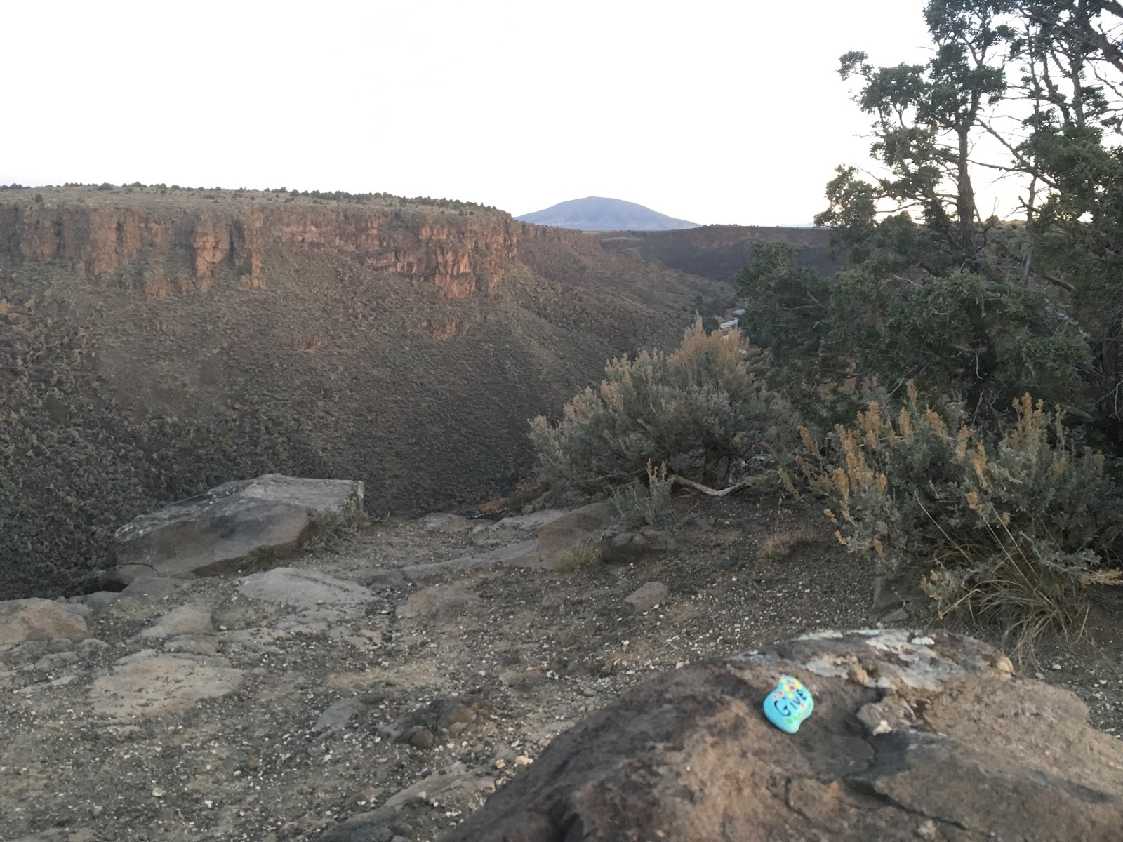
Amazingly the Monument campgrounds are open, for $10 we get an excellent site at the El Aguaje Campground on the bench above the Red River Canyon. We shared the entire campground with the camp host and one other vehicle. Far better than driving back to Taos and setting up at Walmart. We took an evening stroll down into the Red River Canyon, great trails, but not enough time (or inclination) to venture down to the river.
Day 13 Taos New Mexico to Monument Valley Arizona/Utah
 |
| Rabbit pretending not to be there |
Up early again, it's over 350 miles to Monument Valley, would like to get there in time to drive the loop today. There is light on the horizon, but not dawn yet, a rabbit is frozen in the headlights, pretending it's not there. The drive out is a clockwise loop back to the highway. We get our first glimpse of the Rio Grande, another
 |
| Rio Grande Valley |
Rio Grande Gorge
 |
| Rio Grande Gorge jumping off point. |
About 10 miles out of Taos we arrive at the Rio Grande gorge. The Rio Grande carves a huge scar in the surface of the earth here. We find a bridge spanning the chasm that's 565 feet above the river and over 1200 feet long.
It's an engineering marvel of a bridge built in the 1960's, with some refurbishments recently is still state of the art today. We stop for a look, always exciting to walk and look over high places. I don't know why but looking over the railing creates a chemical change in the body that makes a person uneasy.
 |
| Gorge Bridge |
We weren't considering jumping, or at least didn't think we were. Apparently and sadly, many do. Over 100 in last 20 years. Not quite the Golden Gate with 39 in 2016, but for a remote location draws more than its share. Efforts have been made toward suicide prevention at the bridge, such as the call boxes with hopeful messages, maybe they need to look at the stainless steel netting similar to what is being installed at the Golden Gate. At a cost of $200MM funds for netting no doubt will be more difficult to scrape up in rural New Mexico vs San Francisco
EarthShip
 |
| Earthship |
 |
| Typical atypical residence |
A noble vision, and at $300/hour consulting fee, no doubt rewarding for the Earthship founder.
Across New Mexico
 |
| Cell Tower Pine Tree |
 |
| Unique Picnic table sun roof |
 |
| Carson National Forest |
 |
| Rafter of Turkeys on the run |
The next couple hundred miles took us through Carson National Forest and onto Farmington. We crossed a 10,500 foot mountain pass, nowhere near treeline here, still deciduous trees at that elevation. Great ranch land, many cattle grazing. Even saw a "rafter"(who knew that's what a group of these delicious birds are called!) of turkeys crossing the road along the way. We stopped at Blakes Lotaburger and split a delicious burger and shake(it's America, a meal can usually feed 2 or more). Lotaburger is pretty much a New Mexico burger place, been around longer than me, recently they celebrated 65 years flipping burgers.
Shiprock
 |
| Shiprock the town |
 |
| Shiprock the mountain |
Into the Arizona desert
 |
| US160 looking west |
This is inhospitable desert country, marginal pasture at best, maybe a few minerals to extract, a very difficult place to make a living.
 |
| Navajo Nation 27.3MW Solar facility |
Monument Valley
 |
| Approaching Monument valley |
Monument Valley straddles the Utah/Arizona state line. The entry is off US163 just inside Utah, a few hundred feet down the road you cross into Arizona. Not much further on is the entry gate where a $20/vehicle(up to 4 persons) fee is extracted. This gives you access to navigate the self-drive loop, or you can take a guided tour.
We chose the self drive option, a number of reasons, do at own pace, penny pinching Scottish heritage, no desire to ride in back of truck on dusty roads. The 17 mile loop road had been reported by some internet reporters as very rough, needing a 4WD. Others said they had seen sports cars on it. Yes it is indeed rough, washboard, sand, rocks, no I would not take a sports car on it unless it was a rental.There are rarely issues if driven carefully at a reasonable speed, under dry conditions, rain would be a different story.
 |
| West and East Mittens and Merrick Butte |
 |
| John Ford Point |
Monument Valley was brought to the attention of the outside world by Hollywood director John Ford. He made several movies in the valley with John Wayne starring, notably, The Searchers, filmed in 1956, was named the best Western movie of all time. Mr. Ford is remembered here with an overlook named after him.
 |
| In the Spirit of the Duke Photo Op |
Monument Valley has been featured in many other movies including titles as diverse as Easy Rider, 2001 A Space Odyssey, National Lampoon Vacation,The Eiger Sanction, many others. Apparently we don't get tired of seeing on film either.
 Accommodation at Monument Valley can be at pretty much any level. There is a high end hotel "The View", rates $120 to $380 depending on view etc.... not unreasonable. They also have small cabins that go for $225 to $280, again depending on appointments and view.
 The campground, or rather maybe it's better described as gravel parking lot with picnic tables, at $42 is not quite as reasonable. But hey it's Monument Valley. The campground does have a very nice shower/washroom facility and of course, a fabulous view during the day. One odd thing though, they don't take cash. have to pay by credit card or find somewhere else to stay.... go figure. Another 400 mile day awaits tomorrow, sleep comes early.
Day 14 Monument Valley to Park City Utah
 |
| East Mitten and Merrick Butte |
 |
| Mexican Hat |
Mexican Hat is named for an unusual physical feature a little north of town. As can be seen in photo it is aptly named.
We stopped for breakfast at Bluff, pleasantly average place, then hunkered down for a long day on road. After Monticello we are on roads previously traveled, Moab never gets old, even on a quick drive through without finding the coffee hut, it still has much appeal. The drive from Moab to Price is through largely uninhabited desert we have traveled many times before. Green River is the highlight and I have yet to stop there. We get a coffee in Price to fortify us for the next 3 hours over the high country to Duchesne and on to Park City. This route via US191 and US40 is over excellent highways that we have traveled previously. Fine mountain roads, giving way to agricultural lands. Google says it takes an hour longer to get from Price to Ogden, maybe in the middle of night, possibly, but not nearly the pain of driving through Salt Lake on I15. Always a pleasure to avoid the I15 through Salt Lake City.
Park City
 We arrive at Park City mid afternoon. With only one miss-turn in town we find our previously booked accommodation at Treasure Mountain Inn. The Inn is very nice, not too busy in late October, can imagine it's a happening place in ski season/Sundance Festival. We take a tour of Main Street before dining and check out the venue for tonight's concert. The Egyptian Theatre stage will host Chris Hillman, Herb Peterson and John Jorgenson tonight and we have tickets. Not much happening on October 28, shops without customers looking to sell overpriced pretty much everything. We managed to resist any retail therapy here. Two ladies were doing a photo shoot nearby, not sure what they were selling or buying?
 |
| Main Street Park City |
We sat at the bar and sampled a few of the 4.0% beer on tap. The Evolution Ale was very nice and the Jalapeno Cream Ale also acceptable. The Jalapeno Ale is only on tap, no bottles. We had a lively chat with the barkeep who educated us on the challenges of brewing low alcohol beer. He explained that higher alcohol content masks imperfections in taste. Utah law limits draft "beer" to 4% ABV, setting the bar high for brewers. Much harder apparently to make delicious beer at 4% ABV vs 5% or higher. Wasatch seems to have mastered it, their draft was very good. We then headed out to find dinner - the restaurant that looked most promising after checking online reviews unfortunately turned out to be closed for October. We found an open restaurant and headed in, should have kept looking. We shared a plate of ribs, were served the wrong potato choice and the coleslaw was forgotten. The frazzled waitress said they were understaffed. Not like it was full, maybe 4 tables occupied, more under trained or incompetent. The perils of visiting a resort town in the off-season.

The Egyptian Theatre is a standard theatre format venue with capacity of 310. Not as intimate or informal as the Ironwood. Their performance was good, all three are very accomplished musicians. They played Desert Rose, Flying Burrito Brothers, Dillards, Byrds and songs from Hillman's newly released solo album produced by Tom Petty. Unfortunately there did not seem to be a real audience connection like at the Ironwood. Maybe the 40 foot screen behind them that while not featuring a slide show of the performers in younger days, projected video images of the performance, took something away. I was afraid they might look around and be frightened by unnecessary images of who they once were. Binoculars were truly not required. Or maybe it was Hillman chewing out an audience member for talking when he should have been listening, that set a less comfortable tone. Who knows, the boys played a good show... but not a great one like at the Ironwood.
 |
| Wastach Brewpub Halloween |
The barkeep comes back and tells us that it's after 10 and he wasn't aware of that when he took our order, but they are actually closed. What is it with US food and drink establishments closing at 10PM? Fortunately? he was able to get our order in. The beer was still very good but the pizza wasn't so much. He asks us how the food is, not really wanting an answer. I tell him as kindly as possible, not the best I'd ever had. The guys at the next table find that to be hilarious, and the barkeep uncomfortably thanks me for my honesty.
Day 15 Park City Utah to Choteau Montana
We are out on the streets looking for coffee before 9. Went in open door of coffee shop next to hotel; found no one around, heard noise upstairs and called up, no response, not wanting to pull the shots and steam the milk ourselves, we moved on. A little further down the street we find another local non Starbucks with two workers! Testing their expertise I ask for a Flat White, which I had only recently learned was a thing, courtesy of the all knowing drilling engineer. A conference ensued between the staff as to the capability to brew this drink, the barista confidently said it was in his repertoire....wow very impressed.... In a few minutes, coffee in hand we are heading out of Park City.
It's a familiar drive out of the Salt Lake basin, through Idaho and over the Monida pass into Montana. We make the obligatory stop at the Walmart in Helena for cheap American beer. Beer in Montana (and most of the US) is typically less than 2/3 the cost of beer in Canada. Even for Canadian made beer. It's expensive to be Canadian. We consider camping another night, but the sun had set when we arrived at Choteau so we find a room at the Stage Stop Inn. A very modern facility, perfect place to spend a night heading north on US89.
There is a small bar in the hotel, beer, food and gambling can be had close to your room. We spent an hour watching a World Series game, chatting with the barmaid and with fibre optic cable installers from South Dakota who had spent more time recently in Montana than they ever cared to.
The barkeep had moved to Montana to be near her son (and babysit a lot it seemed). She was having fun helping with the rural family life of raising kids in Montana and slinging beer to make a few bucks.The fibre optic installers seemed to be in the 6th month of a 4 month project and longed to be elsewhere. They were working on a nearly $10M project to replace copper wire with fibre optic cables and get rural customers in the Choteau area high speed service. Sad for the 500 residents of Choteau though, the service is only for rural customers. Funded by federal loans with arcane restrictions... maybe they should unincorporate their town?
Day 16 Choteau Montana to White Post Lane
 |
| Duck Lake Road - MT464 |
Maybe I mentioned it is expensive to be Canadian. This can be mitigated somewhat by purchasing online from US retailers and shipping to a point near the border for pickup. Good for obtaining some items that just aren't available in Canada and also very good for those items that are available in Canada, but at egregious prices. For example, a remote start for a Honda generator was quoted at $809CDN at Rocky Honda in Calgary, yet the same item (yes indeed, actual Honda parts) is $195US (about $250CDN) online. Expensive to be Canadian indeed! Lorraine Burns plays Santa Claus all year long to eager Canadians at her Babb Kinek outlet. Not that she gives away the service, but for $4/item(more for big stuff) it's an excellent option to avoid the outrageous costs when importing goods from the US to Canada by mail or courier. Yes, usually have to pay GST if just picking up without spending time in US, but would pay it anyway on a much greater amount if one wants instant gratification and buys in Canada.
The border crossing into Canada at Carway is uneventful. Any firearms, any alcohol/tobacco, what is the most expensive item? I honestly answer all questions concluding with most expensive item being cowboy boots.... he welcomes us to Canada, have a nice day and we are on our way...
We are home at White Post Lane mid afternoon. There are 5100+ more miles on the odometer than when we left 16 days before. A true adventure, time well wasted, as they say.....